Tuesday, July 31, 2012

Day 3 - Joyce Kilmer Memorial Forest 1 - Ramblers 0

Day 3 - The most epic day yet for a host of reasons. Typical start, get up, pack, checkout, and eat in under an hour. Hit up Joey's Pancake House in Maggie Valley for a great breakfast (that would come in handy later).  Rambler Restaurant Tip - You know a place must have good food when it is only open from 7-12 everyday, has a waiting lobby with 20+ chairs and a coffee station for the waitees.  Rambler Rating 5 stars.  We exited Joey's headed for the Nantahala Outdoor Center ("NOC") where our reserved mountain bikes awaited.  Instead of bringing our own bikes I took Rambler Darryl's suggestion to rent bikes and he was right. We got some awesome Specialized dual suspension 29'ers and headed out to the Tsali Recreation Area considered some of the best mountain biking on the East Coast. After a little struggle to find it (a precursor for the rest of the day) we unloaded, geared up and set out on the trails. They did not disappoint with excellent single track and beautiful scenery along Fontana Lake.


It was kind of hot and since we had not  been mountain biking in awhile the steepest climbs took a lot out of us (some more than others).  We did not have a map got a little disoriented (a theme will develop here) but we completed an 11 mile loop in about 2 hours. We pounded some Powerade and headed back to the NOC to return the bikes and take a look around. The NOC is definitely on the list for a more extended stay.  Here is the center of it.


Nantahala River Runs right through the NOC
After a respite and a little shopping at the outdoor gear store we filled The Truck with petrol and took off to complete the final two items on the day's agenda - a short hike through the Joyce Kilmer Memorial Forest and a drive on the Cherahala Skyway. Simple right??? Not for your Ramblers.

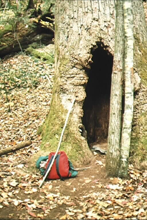
We parked at the designated spot in Joyce Kilmer and left for what we thought was a quick half hour loop to see some old growth timber. Gilligan and the Skipper have nothing on us. Of course with such a short trip we did not take water or any other gear other than Rambler Darryl's IPhone (bless you Steve Jobs and Alexander Graham Bell). What transpired is a six hour slog complete with a dehydrated Rambler (Clydesdale Class), 10+ miles of ground traveled, 3500 feet of elevation gain (and loss), realizing we are lost in a real wilderness (U.S. Gubment designation not your editor's) with night falling, a 911 call, assistance by Graham County's  GREAT rescue squad and a march out of the wilderness in the dark complete with drinking out of streams.  I can see our Master Card commercial: Osprey backpack with room for lots of stuff - $99, a water pack with pockets for tools, knives and 80 ounces of water - $69, a real map - $5,  IPhone flashlight app and getting 3G service at the top of the mountain PRICELESS.  Anywho, after entering the forest at 4:00 pm we left the parking lot at 10:00 pm and decided to make the haul back to The Lodge a mere 3.5 hours away (bad day in the decision Olympics for your Ramblers) and arrived as Garmin predicted at 1:40 am (Tuesday) tired, wiser and hurting.  Day 4 is shaping up to be a rest day.

The tally for the day:

16 hours
One meal (Breakfast), one snack (Cliff Bar)
300+ miles in The Truck
11 miles/2 hrs of mountain biking
One awesome forest seen
10+ miles and 3500 feet of hiking
A mild case of "Sh** we're lost"
One 911 call
5 rescuers
And technically we did make it to the Cherahala Skyway

As always, keep Rambling (but take water and an iPhone).

Go F****** Left


P.S.

For those interested, below is the map at the Joyce Kilmer trailhead. The red "loop" at the far left of the page is the trail we started on - The Naked Ground Trail.  Below is the description of the trail we ended up on with editor's comments in RED


  • railhead: Take the right fork of the Joyce Kilmer Memorial Trail from the parking area.  At about three-tenths of a mile you will come to the Naked Ground Trail junction.  It ascends to the right onto the Naked Ground Trail designated by a wooden trail sign. There is also a trailhead out of the Rattler Ford Campground.
  • Distance: This is a 5.7 mile backtrack trail and is well used and easy to follow. (OH ITS EASY TO FOLLOW ALRIGHT)
  • Difficulty: It is rated as a moderate to strenuous hiking trail with shallow stream crossings. 
  • Use Guide: The Naked Ground Trail is highly recommended for novices or experienced hikers who are in good condition. It would be a challenge for smaller children. With a group at a casual pace, allow 6-8 hours for the round trip. For the more aggressive hiker, 5-6 hours should be sufficient time. Bring water and protective clothing if your trip is going to be more than a few hours.  Hollow Poplar Tree  
  • Description: Follow the signs from the information shelter and you will soon cross the Little Santeetlah Creek footbridge and begin an ascent into an old growth forest. There are benches along the route where you can stop to admire this untouched forest. At about two miles there is an alternate trail.  It is recommended that you stay on the main Naked Ground Trail at all times. On portions of the trail there are may stands of yellow poplars, rhododendron, and hemlock. There are several stream crossings, many with foot bridges in place. On the lower two-thirds of the trail there are campsites available. The upper portion of the trail turns into a switchback and is quite a steep grade. The trail terminates at Naked Ground Gap (YEA WE MADE IT).  There is overused campsites, spring water and the junctions for the Stratton Bald Trail, Haoe Lead Trail, and the Slickrock Creek Trail.  Camping at the Gap can be a rewarding experience. However, be prepared for the possibility of high winds and cooler temperatures any time of the year.

Sunday, July 29, 2012

Day 2 - "Where Can I Park My Car?"

Day 2 kicked off after a less than great night's sleep at The Lodge. Most of the fault is mine. I have never slept well before a trip - I guess it is the anticipation. However, another day, another efficient takeoff. Get up at 7:45, pack stuff for overnight trip, grab a cup of coffee, talk to registration gal for a pancake place recommendation and get there. There being the Banner Elk Cafe in quaint downtown Banner Elk, NC. Great (Ramble Staff 5 Star) place. All three meals, great food, outdoor seating with heaters (if needed) and live music.  Check it out if you are in the area.  After pounding a mega-breakfast  (more later) we headed out  in The Truck at 9:20 for our trip to Maggie Valley. It was a great day for a drive in the mountains.  It took us about 2 hours to reach our destination.

Maggie Valley is a town right off US 74. We arrived here to visit Wheels Through Time an amazing motorcycle and car museum.  It has amazing models of motorcycles from Harley Davidson, Excelsior etc. dating from 1910 up to the 1980s.  AND ALMOST EVERYTHING RUNS!.  They have the rarest motorcycle in the world the 1917 Traub which was found bricked into a wall in a Chicago house in 1967. No evidence of the company exists anywhere!  The American machinery on display is fascinating and recalls and era when we could make the best of just about anything. Well worth the visit even if you aren't a motorcycle aficionado.


Before departing we got some directions (the long way it turned out) from a helper at the museum on how to get to our next stop The Tail of the Dragon.  Deals Gap is a section of mountain road in North Carolina and Tennessee beloved by motorcyclists for its 312 curves in 11 miles.   Before we got there though we took a long route (scenic though) on the Blue Ridge Parkway and managed a stop (longer than expected) at Waterrock Knob Overlook.


We hiked from the parking area where the sign is up another several hundred feet on a very steep climb to get the following shot.  As evidenced by photos in this blog endless supplies of Hokie shirts exists in my closet.


After climbing down we set out again for Deals Gap getting there around 4:00 pm which was much, much later than planned. We made one stop for gas and grabbed iced tea and Cliff Bars (blueberry - yum).  Sorry paleo friends I had to do it. It was a cheat day and I was starving with limited choices. The  number of motorcycles at the base of Deals Gap was impressive though Rambler Darryl says lower than normal. We posed for the typical tourist pictures under the Tree of Shame which consists of motorcycle parts from wrecked motorcycles (wrecks are pretty frequent - Google Deals Gap and watch some youtube).


We then took off to attempt The Tail of the Dragon in The Truck with Rambler Darryl at the helm. While we did not scrape our kickstand we did about as much as I want to do in a very tall, 4x4 with off road style tires.  In fact I have to say I am pretty proud of how well it handled.  I took us back down after we completed the eleven mile outward bound trip. (Editors Note - it is easier to be a driver in this type of situation than to be the passenger. Now I now how Rambler Jane feels most of the time I drive. As we headed home we took the more direct route and went through the Cherokee Indian Reservation which is non-descript except for the massive new hotel next to their casino. WOW!

We got checked into our Ramada abode and dealt with the sarcastic front desk lady.  When I asked where I could park The Truck her answer was "in the parking lot".  After no lunch, 300 miles of driving including a bunch on twisty mountain roads I was not in the mood for 70 year old sarcasm. Is it morally wrong to smack an elderly lady????

Enough for today. Tomorrow is busy with mountain biking in the Nantahalla National Forest, a visit to a virgin timber stand in the Joyce Kilmer Memorial Forest and a run across the Cherohalla Skyway before returning to Banner Elk.

Till then.....keep rambling.

Saturday, July 28, 2012

Day One - God Loves Soul Food

Day 1 of the inaugural Ramble has been a success. 350 miles traveled, two very cool towns discovered (Boone and Blowing Rock) and one sight seen (The Blowing Rock).

The day started on time when I met fellow Rambler Darryl at his house around 8:15. By 8:20 we were in "The Truck" and on the road - amazing the speed that can be obtained by the unconstrained (re: no wives or children) male with a goal.   We hit the NC/VA border about 10:00 am and hit the first NC rest stop.  A coffee removal exercise and a pamphlet heist from the Chamber of Commerce office later we were back on the road.  The Chamber of Commerce office is very nice and offers pamphlets organized by areas of the state and we hit it hard. We also managed to procure a NC road map from the lovely ladies manning the office.  We rambled through the state for the rest of the morning before Hance demanded a food stop (breakfast actually) at the Henderson Chick-fil-A.  I know they have issues with gay marriage but the people are so polite and the establishments always clean. Chicken strips, coffee and a chicken biscuit to go and we were back on the road. Again, the speed and efficiency were stunning in their beauty.  We continue our unimpeded rambled until the gas light lit up before  the gas gauge hit "E" at about mile 300. Anyone that has been in "The Truck" knows a gas light is not a trivial matter especially in hilly country so a brief backtrack was in order to the last gas station seen. It is about this time we saw the first memorable sight of the day.


I am sure God is in everything but didn't know he was a soul food fan.

The Ramble rolled into Boone, NC about 1:30pm which was close to what Garmin said it would be. How does she know that??  Boone was bigger than imagined having visualized a quaint little hamlet with the ASU campus and very little else. While ASU is clearly there and very pretty, the town proper is larger than I ever imagined, very prosperous looking with a certain crunchy granola vibe that is to be expected in a mountain college town with tons of outdoor activities all around.  As always I check local real estate when traveling (nothing says how things stack up more than the price of a 3 bed, 2 bath abode).  In short, Boone ain't cheap.  Chic is winning over granola I guess.  We ate stupendous sandwiches at a place called Our Daily Bread and ambled about the town getting an early feel before departing for Blowing Rock.

Blowing Rock is the NC equivalent of Tiburon/Sausilito. Alpine village feel and architecture, strict guidelines for building, charming little "shoppy" downtowns and high price real estate (though less high than it formerly was based on the "now marked down to.... lines on the listing sheets in real estate firm windows).  We walked around and took a self guided tour of this charming church (Episcopal of course)


before moving on to the actual Blowing Rock.

While The Blowing Rock entrance is a little annoying - through a gift shop and $6 later the views don't disappoint nor does the wind at that level.  Here is the sight of Grandfather Mountain in the distance.

Here is a picture of your intrepid Ramblers at The Blowing Rock

We finally left to find and check into our hotel. The Smoketree Lodge near Banner Elk.  It is an older place with amenities and "character" that always make trips memorable but it has the two essentials for any Ramble - good air conditioning and decent cable TV.  We got settled in, downloaded the days pictures and set out to find an eating establishment.  (Earlier in the day we established the first rule of the trip - No eating at chain establishments unless absolutely necessary).  We made it into Newland and hit up San Dee's Cafe for a burger and hamburger steak (ummm - nutrition).  We also visited the local grocer for room essentials --water, beer, donuts, beef jerky and other snacks.  All in all a very good start to the week.

Tomorrow we are off to Maggie Valley.

Until then....Keep Rambling!